The history of Guardamar del Segura Castle
The history of Guardamar del Segura Castle: its medieval origins, the 1829 earthquake, the Caliphal Rábita and how to visit the site today.
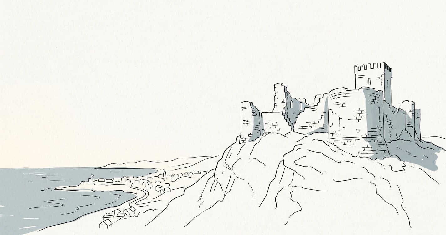
Guardamar Castle is the sum of almost twenty-seven centuries of occupation on the same hill. Phoenicians, Iberians, Romans, Muslims and Christians built, used and altered the defences of this high ground overlooking the mouth of the Segura River, until the earthquake of 1829 forced the town to move down to the plain. What visitors can see today at the top of the town are the walls, bastion and silos left by that long history, which began long before the name Guardamar existed.
This guide explores the medieval origins of the site, the earthquake that changed the town’s appearance for good, the Rábita Califal archaeological site in the dunes, how to visit the historic complex today, and what it all means to Guardamar’s identity.
A hill occupied since the Iron Age
Long before the walls and the Christian name, the castle hill was already a strategic location. Archaeologists date the earliest remains of occupation to around the 8th century BC, during the Iron Age, when Phoenicians and Iberians took advantage of its commanding position above the mouth of the Segura and access to the sea.
One of the town’s most remarkable finds comes from the Iberian period: a sanctuary where terracotta votive offerings were recovered. These small figures were left by worshippers as offerings and are now kept at the Guardamar Archaeological Museum. The Romans came later, followed by the Andalusi presence, which left its mark both on the hill itself and in the nearby dunes.
According to the Town Hall’s official tourism website, the hill was continuously occupied from the 8th century BC until the 19th century, when the earthquake brought life on the hill to an end. This continuity makes the castle an archaeological site of overlapping layers, where each culture reused what it found.
What the name Guardamar means
The place name itself offers a clue to the hill’s purpose. Guardamar is generally interpreted as “guardian of the sea” or “watcher over the sea”, a reading that fits with the castle’s position above the mouth of the Segura. From the top, it was possible to monitor both river traffic heading inland towards the Vega Baja and ships approaching along the coast.
This dual watch over river and sea explains why the site was fortified time and again. Whoever controlled the hill controlled the gateway to the Segura, a route inland towards Orihuela and the orchards of the Vega Baja. In that sense, the name describes exactly what the fortress was for.
Access to the sea also shaped the local economy. The sandbar, fishing and, later, farming in the huerta all helped shape a town oriented towards the water, something that can still be seen in the local cuisine and in traditional products from the comarca, such as ñora peppers in the Vega Baja, as well as in traditional trade.
The medieval origins of the walled town
The Guardamar we recognise as a town emerged in the 13th century, during the repopulation drive of the Crown of Castile and, shortly afterwards, that of Aragon. After the Christian conquest of the area in the middle of the century, Alfonso X the Wise founded Guardamar as a newly established royal town around 1271, with settlers arriving from northern Spain, according to the municipal tourism website.
Its position on the frontier shaped everything. Guardamar lay along the border with the Nasrid Kingdom of Granada, and this tension explains why it was so important to fortify the hill. At the beginning of the 14th century, royal permission was sought to build proper defensive walls, and the site expanded to form two sections: an upper part, containing the castle itself, and a lower part protected by a Gothic wall that enclosed the town.
Life on the frontier came at a price. In 1331, Granadan troops sacked the town as part of a larger raid against Orihuela, a reminder of just how much these walls served as the last line between local residents and danger.
What remains of the walls
Today’s visitors will find consolidated sections that make the original layout legible, rather than an intact fortress. Remains of medieval walls and towers, grain-storage silos cut into the ground and the outlines of the gateways have survived. Walking around the site means following the perimeter that for centuries marked where the town ended and the countryside began.
To understand the natural surroundings of the hill, it is also worth looking towards the river mouth and its paths. The trails along the river help place the castle in the landscape that made it strategic: the river, the sandbar and the sea.
The 16th-century Renaissance renovations
The medieval castle did not remain frozen in time. During the 16th century, when the threat came not from Granada but from Barbary piracy and new forms of warfare, the site was adapted to artillery.
The walls were set further back, late-medieval towers that had become obsolete were lowered, and the so-called Baluarte de la Pólvora (Gunpowder Bastion) was built. This structure was designed to withstand and return cannon fire. This type of bastioned fortification, with thick walls and carefully calculated angles, reflected the military engineering that spread across the Mediterranean during that century.
The result is a hybrid site where the Gothic layout sits alongside Renaissance features. This mixture is part of its value: within a few metres, visitors can trace the evolution of defences from the medieval tower to the modern bastion.
The earthquake of 1829: the day Guardamar changed
All the history that came before was split in two on 21 March 1829. That afternoon, an earthquake with its epicentre in the Vega Baja area shook the comarca with a force not seen for centuries. The National Geographic Institute puts its magnitude at 6.6 Mw and its maximum intensity at IX–X on the intensity scale.
The National Geographic Institute’s official figures for the 1829 earthquake show the scale of the disaster: more than 800 people died and at least 53 towns and villages across the area were affected. In Guardamar del Segura, the intensity reached level IX, enough to ruin the buildings on the hill.
The old town, packed onto the hill beside the castle, became uninhabitable. Houses collapsed and the walls were damaged; the place that had provided security for centuries suddenly became a hazard. Life on the hill came to an end.
From the hill to the plain: rebuilding
The decision made after the earthquake shaped the Guardamar of today. Rather than rebuild at the top, the population moved to the plain at the foot of the hill, where a new town was laid out with wider, more orderly streets. Much of the stone from the old town was reused to build new homes, so the modern town centre literally contains fragments of medieval Guardamar in its walls.
This move explains something that surprises visitors today: the castle stands above the town, separated from its bustle, like a quiet viewpoint over what once was. The earthquake destroyed buildings and also reshaped the municipality’s human geography, pushing life towards the plain and, in time, towards the coast.
Visitors to the area at this time of year can combine the historic route with a look at the forecast: it is worth checking the weather before climbing the hill, as the easterly wind can be strong at the top.
The Caliphal Rábita, a treasure beneath the dunes
A short distance from the castle, in the dunes on the right bank of the river mouth, lies the archaeological site that has made Guardamar internationally famous: the Rábita Califal de las Dunas. It is an Islamic monastic complex, a kind of fortified monastery devoted to spiritual retreat, the study of the Quran and pilgrimage.
Its significance is hard to overstate. It is considered the best-preserved example of this type of Islamic religious building, a ribat, anywhere in the Iberian Peninsula. While elsewhere only foundations or documentary references remain, in Guardamar almost the entire layout of small prayer rooms, cells and streets that organised the community’s life has survived.
The foundation date is documented with exceptional precision. In 1897, during work to reforest the dunes, a foundation plaque in classical Arabic was discovered. It dates the site to 944, during the caliphate of Abd al-Rahman III, and records the names of its patron and builder. The inscription is what allows the complex to be dated so precisely.
Excavation, layout and abandonment
Systematic archaeological excavations began in December 1984 and gradually revealed a complex organised around around twenty individual prayer rooms, arranged in several areas separated by internal streets. Each cell had its own small mihrab facing Mecca, a detail that gives a sense of the intimate, personal nature of the retreat.
Life at the rábita ended around the middle of the 11th century, probably because of an earthquake that caused walls and mihrabs to collapse, an early echo of what would much later happen to the Christian town. The dune sands that covered the complex for centuries paradoxically became its best form of preservation.
The site is protected as a Bien de Interés Cultural (Asset of Cultural Interest), in the Archaeological Zone category, under Royal Decree 1064/1990, which formally recognises its exceptional value. For more technical information and context, the Wikipedia entry for the Rábita Califal de las Dunas de Guardamar brings together the available documentation.
La Fonteta, the Phoenician city beneath the rábita
As if a Caliphal monastery were not enough, a Phoenician archaeological site dating from the 8th century BC, known as La Fonteta, lies beneath the rábita itself. The same dunes that protected the Islamic complex also preserved the remains of this much older settlement, making the area around the river mouth one of the most archaeologically rich parts of Alicante province.
The relationship between the pine forest, the dunes and these archaeological sites is no coincidence. The dune belt that now stabilises the centuries-old pine forest was what sealed and preserved these ruins. The story of that reforestation is told in the feature on Guardamar’s dunes and its centuries-old pine forest, an essential chapter in understanding why so much heritage has survived.
How to visit the historic site today
The castle and the vila murada (walled town) are open to the public and can be explored on foot from the town centre. The climb up the hill is short but steep, so comfortable footwear is recommended. In summer, avoid the hottest part of the day. From the top, there are some of the best views of the river mouth, beach and pine forest.
Within the site, visitors can see restored sections of the medieval wall, the Baluarte de la Pólvora, the storage silos and defensive remains marking the perimeter of the old town. Information boards help place each feature in its historical period, from the Iberian foundations to the 16th-century renovations.
The MAG, the final piece of the visit
To understand what can be seen on the hill, it is worth visiting the Guardamar Archaeological Museum, the MAG, on calle Colón in the town centre. It houses the Iberian votive offerings from the castle sanctuary, materials from the Rábita and finds from La Fonteta, making a visit to the archaeological site and the museum a perfect complement to one another.
The Town Hall also organises guided tours combining the museum and the fortified site, in Spanish and English, for residents and visitors alike. It is worth checking opening times and prices before going, as they vary by season, and booking through the Town Hall’s official channels.
How to get there and what else to see nearby
The hill is just a few minutes’ walk from the town centre and the beach, so it is easy to fit the visit into a full day in Guardamar. For visitors travelling from Alicante or Torrevieja, road and public transport links are straightforward, and the old town is a short walk from the site.
The climb to the castle goes well with a walk through the pine forest and along the beach, followed at lunchtime by local food. It is the classic day out in town: history in the morning and rice by the sea at lunchtime.
The best time of year to visit the castle
The hill can be visited at any time of year, but the experience varies considerably from month to month. Spring and autumn are the most comfortable seasons, with mild temperatures, fewer visitors than in the height of summer and light that brings out the views over the river mouth and pine forest.
Summer brings beach tourism and, with it, the heat. If you visit between June and September, it makes sense to go early in the morning or in the late afternoon, take water and sun protection, and make the most of the fact that many guided tours are scheduled for the evening for this very reason.
Winter has its own appeal. On clear days, the views are far-reaching and the site can be explored without crowds, although the easterly wind can pick up at the top, so it is worth bringing warm clothing. Whatever the season, comfortable footwear is essential because of the slope and uneven surfaces in some areas.
A practical tip: a visit to the castle fits in well with the rest of what the town has to offer, from the weekly market to its rice dishes. Planning the day in advance makes it possible to combine history, beach and a meal without rushing.
The castle and Guardamar’s identity
Beyond
This is an automatic translation of an article originally published in Spanish by La Gaceta de Guardamar. If in doubt, the Spanish version prevails. Read the original · More news in English