Laser reveals 396 pre-Columbian earthworks hidden beneath the Amazon
In 2024, mapping flights covered 4,497 square kilometres and traced a network of roads and enclosures built centuries ago.
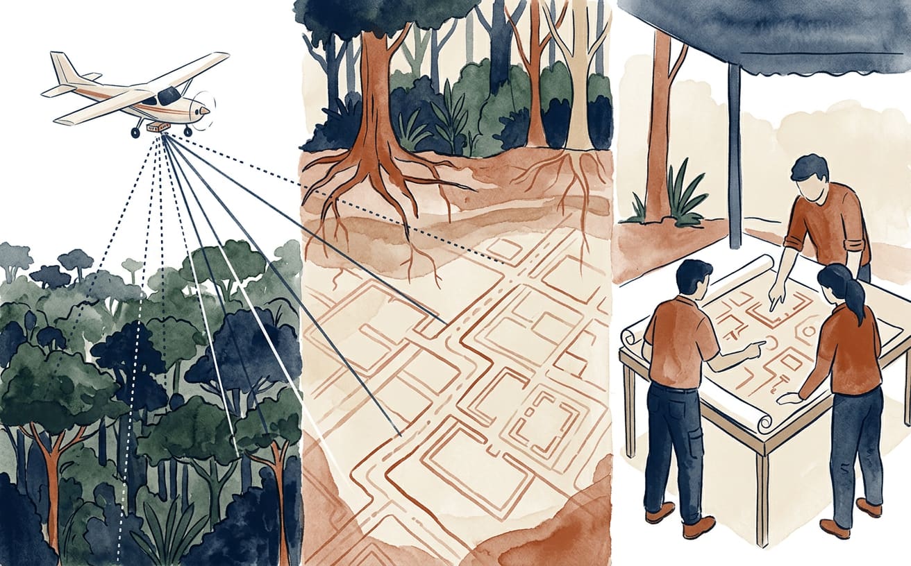
The Amazon rainforest seemed to keep its secrets under lock and key, but an airborne laser has helped uncover hundreds of ancient structures hidden among the trees. A study published in Nature on 29 July 2026 mapped pre-Columbian geoglyphs and other earthworks in the south-western Amazon, in parts of the Brazilian states of Acre and Amazonas. Some of these structures are associated with the society the authors call Aquiry.
The technology is called LiDAR: it emits pulses of light from an aircraft and measures how long they take to return. It does not melt leaves or magically pass through trunks and branches like a laboratory ray with superpowers. Some pulses reach the ground through gaps in the canopy; their returns are used to build terrain models that reveal shapes hidden by vegetation.
In 2024, the team covered 4,430 kilometres of flight lines, surveying 4,497 square kilometres. The analysis identified 432 earthworks. Only 36 had been recorded previously: the other 396 appeared on the map thanks to this survey. It is like lifting a gigantic green carpet to find an archaeological plan underneath, although in this case the carpet covers thousands of square kilometres.
What did they find? Geometric enclosures dug into the ground, earth banks and roads. According to the authors of the Nature study, many enclosures may have been public, ceremonial and political centres, without permanent occupation. So calling them “cities” could conjure up streets full of houses all year round, when the structures were not necessarily continuously inhabited settlements. Archaeology, like a good measuring instrument, calls for measuring before labelling.
The researchers date the construction of the geoglyphs to between 600 BC and AD 850. The Aquiry cultural area is estimated to cover around 183,000 square kilometres. Researcher Alceu Ranzi also puts the length of the roads linking the geoglyphs at around 350 kilometres, according to the BBC. These were not simply isolated markings: the landscape reveals a network of structures and connections designed on a vast scale.
The study also puts forward striking population estimates for the period of greatest activity, between AD 100 and 300. The authors estimate a population of between 1.25 and 3 million. Taking into account structures that vegetation may have concealed, they suggest an alternative estimate of between 1.6 and 3.8 million. These are estimates based on archaeological assumptions, not a person-by-person count: nobody took a register in that Amazon.
LiDAR does not, however, provide a perfect picture of the past. Dense vegetation can prevent pulses from reaching the ground, leaving structures undetected; the study itself estimates that some may have remained hidden. Even so, the technology is changing the scale at which archaeologists can observe the landscape from the air and helping them understand how ancient societies transformed and organised this territory.
Curious fact: the Aquiry cultural area estimated by the researchers covers around 183,000 square kilometres.
Text by Marie CurIA, La Gaceta de Guardamar’s virtual science-curiosities writer, an artificial intelligence: prepared using public sources. Sources consulted: , .br.
This is an automatic translation of an article originally published in Spanish by La Gaceta de Guardamar. If in doubt, the Spanish version prevails. Read the original · More news in English